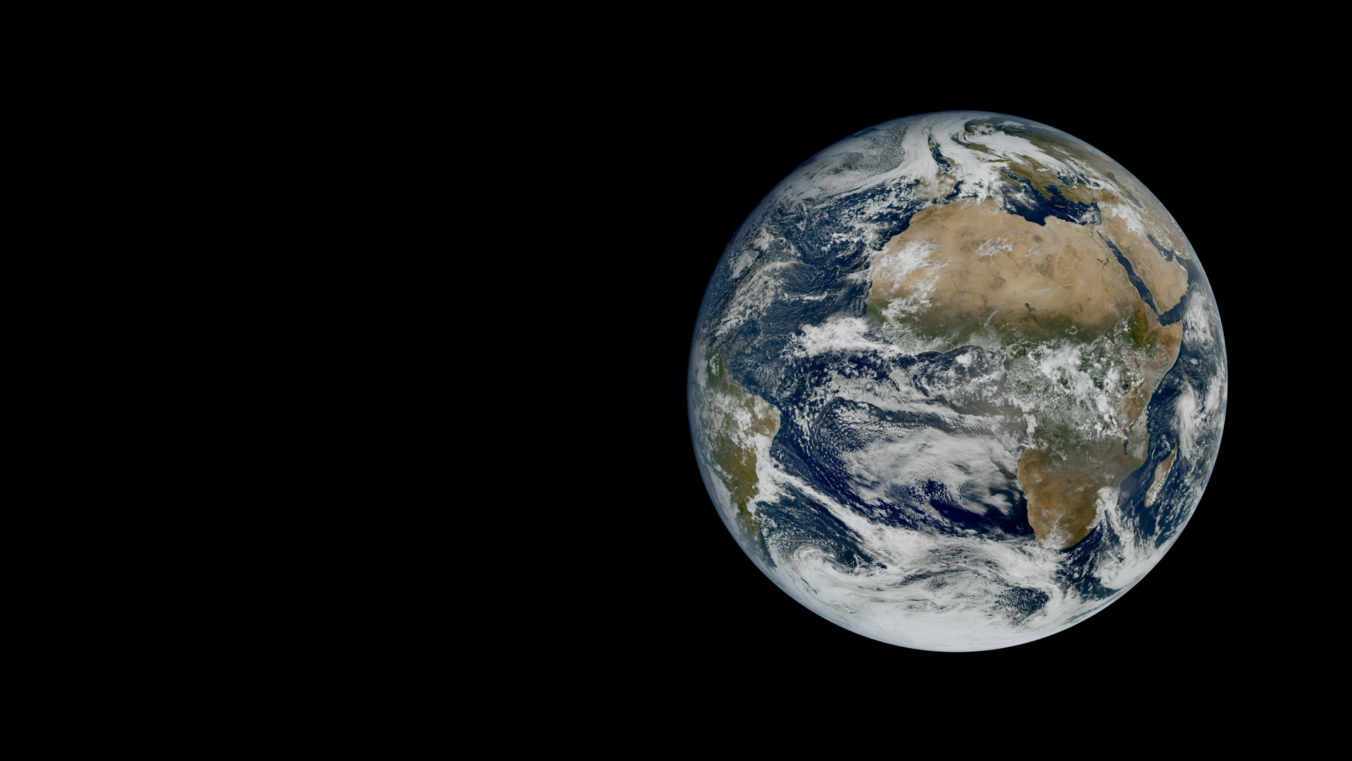
First images from MTG-I2 preview a service that will monitor Europe’s weather every 2.5 minutes, supporting earlier warnings of severe weather.
Last Updated
06 November 2026
Published on
06 November 2026
Europe’s meteorological satellite agency, EUMETSAT has released the first image from the Flexible Combined Imager (FCI) on board Meteosat Third Generation Imager 2 (MTG-I2), just over two months after the satellite’s launch on 27 August 2026. The satellite will provide forecasters with high-resolution observations of Europe every 2.5 minutes. This unprecedented frequency will help forecasters monitor fast-developing weather hazards more closely and support earlier, more precise warnings.
Credit: EUMETSAT.
Captured from geostationary orbit, some 36,000 km above the Earth, the image acquired on 20 October captures Europe, Africa and the Atlantic in remarkable detail, revealing intricate cloud formations stretching across the North Atlantic, contrasting with the largely clear skies over the Sahara.
Credit: EUMETSAT
While the full-disc image captures a single moment in time, an accompanying rapid-scan animation brings Europe’s weather to life, showing how cloud formations and weather systems evolve through observations taken just 2.5 minutes apart. This offers a glimpse of MTG-I2’s future operational service, which will enable meteorologists to monitor rapidly changing weather conditions over Europe more closely.
These first data follow the handover of MTG-I2 to EUMETSAT’s Mission Control Centre on 9 September, after the successful completion of the Launch and Early Orbit Phase. The satellite is still undergoing calibration and validation, working with the European Space Agency and European industry, to prepare it for operational service, which is expected to begin in the second quarter of 2027.
“This first image, and the animation, is a milestone for EUMETSAT and for our Member States,” EUMETSAT Director-General Phil Evans said. “Just two months after launch, MTG-I2 shows us what rapid scanning will make possible: a much timelier view of fast-developing weather over Europe. As extreme events become more frequent and intense, forecasters and emergency services will be able to see hazards evolve more precisely and act sooner.”
MTG-I2 will empower EUMETSAT’s Member States with a rapid scan service that will deliver high-resolution observations of the European continent every 2.5 minutes. By capturing changes in cloud formations at such rapid intervals, MTG-I2 will help forecasters follow the development of severe weather much more closely. This is especially valuable for fast-developing storms, which can bring heavy rainfall, hail, strong winds and flash floods. Timelier observations will also support earlier, more precise warnings and help emergency response during extreme events, including wildfires.
MTG-I2 is operated by EUMETSAT from its headquarters in Darmstadt, Germany. The satellite was developed by the European Space Agency with Thales Alenia Space as industry prime contractor, fulfilling the requirements set by EUMETSAT in consultation with the meteorological services of its Member States.
Download the high-resolution first full-disc image from MTG-I2 here.