Permission to conduct the excavations was granted by the Dirección General de Patrimonio Cultural of the Comunidad de Madrid.
Field methods
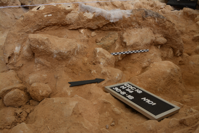
When the excavation of the site began in 2009, a grid of 1 m2 squares was established. Each square was identified by a letter and a number. The letters grow towards the east, and the numbers grow towards the north.
The excavations were concentrated in the sector of the cave called La Monumental. The filling of the cave is well marked in terms of width by the walls of the cave. Given the need to know the cave’s complete stratigraphy, a trench with an approximate east–west direction began to be excavated in this sector in 2015. This trench occupies line 42 in the plan of the site (Extended Data Fig. 7). Excavations are still underway; the base of the fill has not yet been reached.
Excavation was carried out by archaeological level and, within each level, by artificial intervals (10 cm thick). The locations of the archaeological and palaeontological material and blocks of extracted rock were recorded with respect to an absolute coordinate system (datum ED50) using a motorized Leica total station (model TCRP 1205 R400). All data were exported to Excel 17.0 and then to a FileMaker Pro 7.0v3 database.
Stratigraphic levels were described, measured, logged using scaled drawings and photographed. Level limits were measured and recorded using a total station. Representative samples of each level from freshly scraped exposures were collected for granulometric analysis. Sieves (−1 to 4 φ) were used for measuring grain size distribution; sediment types were classified on the basis of this distribution63.
All the lithic industry detected was collected and drawn, regardless of size, as well as bone fragments over 2 cm (on the longest axis). All blocks of carbonatic rocks larger than 20 cm were also documented. All field drawings were made at a scale of 1:10 and digitized using a Wacom Intuos 4 professional pen tablet.
The coordinates of archaeological items were analysed spatially using AutoCAD 2021 and QGIS v.3.22. Different plans and sections were made from the spatial data to facilitate its visualization. These products were used to determine whether the distribution of the archaeological materials was homogeneous over the site’s extension or whether they appeared concentrated in specific sectors. The transversal and longitudinal sections allowed the vertical succession of the materials to be visualized and, taking into account the data derived from the geological and taphonomic studies, allowed temporal relationships between them to be established. The recovered objects were represented by their coordinates on the x, y and z axes in all plans and sections. The outlines of the large mammal crania were drawn in these plans and sections using information from photographs, field drawings and the spatial data.
Each recovered element was stored separately in a sealed plastic bag with its corresponding label containing information on the level, sublevel, square, order of recovery in that square, type of material, z coordinate (depth) and date. Larger fossils, also labelled, were stored in a container suitable for their characteristics. Only unidentifiable bones smaller than 2 cm from within the same square were kept together in a ‘level bag’; their coordinates were not recorded.
All excavated sediment was stored in bags labelled according to its origin (square stratigraphic level and depth range) for later pressurized water washing over a set of superimposed sieves.
Human remains
The available mandible and isolated deciduous teeth were μCT-scanned to provide a virtual reconstruction of the mandible and to assess the developmental stages of the permanent dentition inside the mandibular corpus. All scanning was performed at the maximum resolution obtainable using a Phoenix v|tome|x s scanner (GE Measurement & Control) at the Centro Nacional de Investigación sobre la Evolución Humana (CENIEH) in Burgos, Spain. The isolated teeth were aligned along their long axis, with the crown placed upwards. Slices were then obtained in a 527 × 734 matrix in Dicom format, with an isometric voxel size of 0.019 mm (scanner energy, 110 kV; field of view, 0.9 cm). For the mandible, slices were obtained in a 1,880 × 1,176 matrix in Dicom format, with an isometric voxel size of 0.025 mm (scanner energy, 110 kV; field of view, 4.6 cm).
Virtual reconstruction was performed using Mimics v.18 software (Materialise), relying on semiautomatic segmentation to define Hounsfield values for dentine, enamel, bone and air. The virtual reconstruction of the mandible was performed taking into account the sagittal plane (symphysis) and mirror-imaging the preserved portions.
Faunal remains
Reference collections and bibliographic sources were used for the identification of microvertebrate remains (rodents64, lagomorphs65, insectivores66,67, chiropterans68,69,70,71, amphibians72,73,74,75,76 and reptiles77,78,79). The systematics used in this work are those previously proposed for rodents80,81, insectivores82, chiropterans83, lagomorphs80, and amphibians and reptiles84,85.
Atlases of animal anatomy86,87,88,89 and additional comparative data from bibliographic sources22,90,91,92,93,94,95 were used for the anatomical and taxonomic identification of large mammal remains. For bovine remains, identification also involved the use of the criteria of the Natural History Museum of Rotterdam (the Netherlands) and the Department of Geology, University of Oviedo (Spain), as well as skulls of current Bison bonasus provided by the Palaeolithic Vivo Park (Salgüero de Juarros, Burgos, Spain). For the rhinoceros remains, other sources were consulted96,97. In-house data for modern Panthera leo collections and Panthera spelaea specimens (from the Museum of Vertebrate Zoology—UC Berkeley, the Smithsonian Institution, the British Museum, the Sociedad Aranzadi and the Institue für Quartarpalaontolgie Weimar) were used in comparative analyses.
Measurements were taken using a Mitutoyo digital caliper, recording to the nearest 0.05 mm. The osteological and dental terminology used, and the measurements made of teeth and bones, were those previously proposed98.
The data collected for each bone remain were anatomical element, taxon, size, position, age, portion and side99. Six measurements of abundance were recorded: the number of specimens (that is, the total number of faunal remains independent of their level of identification)100, the NISP, the MNE, the MAU, the standardized %MAU and the MNI101,102.
Non-identified specimens were included in three bone categories: long bones, flat bones and articular bones. Bones that showed structural features of ribs and vertebrae were classified as indeterminate flat bone/vertebra/rib. The non-identified specimens were classified into three size categories depending on the modified criteria of Rodríguez-Hidalgo103, who in turn modified the categories proposed by Brain104 and Bunn105 in their studies on extant African fauna and those of Díez Fernández Lomana106 (Supplementary Table 5).
To express the relative abundance between carnivores and ungulates (C/U ratio), the following ratio proposed by Thackeray21 was used:
$${{{\mathrm{C/U}}}}\;{{{\mathrm{ratio = }}}}\left( {{{{\mathrm{MNI}}}}\;{{{\mathrm{of}}}}\;{{{\mathrm{carnivores/ MNI}}}}\;{{{\mathrm{of}}}}\;{{{\mathrm{ungulates}}}}} \right) \times 100$$
In the present work, NISP values were used instead of the MNI values to calculate this index.
Palynology
For the extraction of pollen grains from each of the studied samples, the sediments were chemically attacked using acids and alkalis according to standard protocols107. The residue was then subjected to enrichment by flotation in a heavy liquid of density ≥2. The residues were mounted on slides and examined under a light microscope. For each slide, pollen grains were counted along 42 rows covering the entire surface of the slide. Some of the samples from Levels 5 and 3 contained <100 grains; a pollen presence histogram was used to represent the results. Taxa were recorded as arboreal, shrubby and herbaceous types. The statistical treatment of the data, as well as their graphical representation, was undertaken using TILIA software108,109.
Evidence of thermal alteration and hearths
A collection of different archaeological materials from the cave was examined macroscopically to search their surfaces for any signs of alteration by fire and to characterize these signs. A spatial distribution analysis of the studied materials was then performed using AutoCAD and QGIS software. The location and arrangement of remains affected by fire within the deposit facilitate and complement the identification of areas where combustion occurred110,111.
The dolomite clasts forming part of the sediment matrix of Levels 2 and 3 sometimes showed signs of having been affected thermally. These were identified and classified as previously reported112 for carbonated sedimentary rocks, taking into account changes in coloration, cracks and alterations caused by high temperatures.
Some lithic industry artefacts and remains showed signs of exposure to heat and fire, as determined by the presence of potlidding, cracking and flaking, loss of shininess (for quartz), colour changes, thermal lustre, and fractures (in flint). Several studies have reported common alterations to different raw materials caused by fire, including quartz113, while others have recorded the differences between naturally and intentionally heat-treated flint114,115,116.
Some of the bone remains also showed signs of thermal alteration. The main feature of burned bones is the change in colour related to the intensity of the fire and the time of exposure. The burned bones from this assemblage were clustered into five colour groups117,118: Grade 1, brown points dispersed across the bone surface; Grade 2, brown stains more or less homogeneous across the bone surface; Grade 3, black stains where the bone was charred; Grade 4, grey and white stains, although occasionally with bluish veins; and Grade 5, calcined and completely white.
Charcoal fragments were identified taking into account the specialized literature on their recognition via the internal structure of the fragments and the taphonomic processes undergone119,120.
Taphonomy
The surfaces of all remains recovered were examined macroscopically and microscopically using an Olympus SZ1144TR (×15–×40) binocular microscope and a DigiMicro 2.0 Scale (×20–×200).
Cut marks were identified on the basis of previously proposed criteria121,122,123,124. The distribution, incidence and morphology of cut marks allows for the identification of different butchering activities121. Percussion pits, conchoidal scars, flakes and peeling caused by the anthropic breakage of the bones were also sought125,126,127. The presence of damage and its location were recorded for each of the remains analysed.
Carnivore modifications (tooth marks) were sought in the form of pits, scores and perforations121,128. The length and the width of these tooth marks and their location were recorded129,130,131,132. The presence of pitting and furrowing was also noted121,133.
Post-depositional modifications were noted in terms of presence/absence. Most of these modifications (black manganese oxide stains, dissolution, rounding and polishing by water abrasion, and concretions) are associated with the karstic depositional environment in which the materials were found134,135,136.
All faunal remains were subjected to classic taphonomic analysis. In addition, experimental butchering was performed to compare the results of the breakages made with the collected morphotypes. Three cow (Bos taurus) heads were butchered (one each by three experienced butchers) following different strategies to extract the brain. The butchers tried to identify the easiest way to extract the edible resources (eyes, brain and meat), always from a qualitative point of view (no quantitative data were collectable). In all cases, the butchers used stone tools (simple flakes) made from the raw materials (quartz, quartzite and porphyry) present in the lithic record for the site. All the raw materials were collected in the surroundings of Pinilla del Valle.
All experimental processes were undertaken at the Valle de los Neandertales Archaeological Park enclosure under natural conditions to reduce any possible bias produced by laboratory conditions (under which butchering is ergonomically easier).
The first stage involved the skinning of the heads. Most of the muscles (for example, the tongue) were then removed and the mandibles extracted (in agreement with the absence of these elements in the site) using gneiss, quartz and porphyry hammerstones. These raw materials were selected for use as percussion tools since most of the hammers found at the Pinilla del Valle sites (including the Cueva Des-Cubierta) are made from these kinds of rock. When the crania and mandibles were completely separated, the maxillae were removed. The zygomatic arches were then removed using hammerstones to extract the eyes.
Finally, the brain was extracted by (1) breaking the ventral part of the cranium, hitting it near the basilar part of the occipital bone; the brain was then extracted from within this area; (2) hitting the squamous part of the occipital bone (on both sides of the sagittal crest) with a hammerstone and then extracting the brain from within this area; or (3) hitting the frontal bone with a hammerstone and then extracting the brain from within this area. These three options were followed to check whether any provided an easier way to extract this organ.
Radiocarbon dating
Several samples (charcoal and charred bones) from Levels 2 and 3 were sent to the Oxford Radiocarbon Accelerator Unit for radiocarbon dating by accelerator mass spectrometry using the ultrafiltration method. The chemical pre-treatment, target preparation and accelerator mass spectrometry measurement were as previously described137,138. Only one of the samples (OxA-31346, a charcoal fragment from Level 2) could be dated. The result was calibrated using OxCal v.4.4 software139 and the IntCal20 calibration curve140. The calibrated age was expressed in anni cal BP (95.4% confidence or 2σ). The dating results are available in the Supplementary Results under ‘Radiocarbon dating’.
Uranium/thorium dating
The underlying speleothems S1 and S2 were sampled (using a hammer and chisel) for dating by the U/Th method to provide an estimate of the maximum age of Level 3. The S1 sample was divided into two. One part was sent to the Uranium Series Laboratory of the CENIEH, and the other to the Geochronology Laboratory of the Jaume Almera Institute of Earth Sciences (CSIC). S2 was dated at the CENIEH Uranium Series Laboratory.
The methodology and dating protocols used at the first of these laboratories have been previously described141. This facility works with small samples (around 50 mg); different subsamples taken from across the thickness of the speleothem could therefore be dated. The individualized datings obtained cover the interval of formation of the speleothem. The methodology and dating protocols used at the second laboratory are described elsewhere142. This laboratory works with bulk samples and therefore analysed the speleothem as a whole, obtaining an average age for the time interval during which it formed.
Reporting summary
Further information on research design is available in the Nature Portfolio Reporting Summary linked to this article.